| Category |
Details |
| Capital |
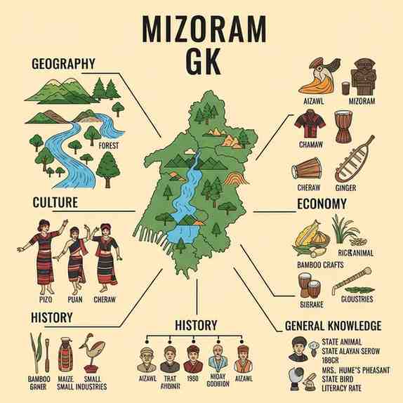
Aizawl |
| Statehood |
20 February 1987 (23rd state of India) |
| Official Languages |
Mizo and English |
| Area Rank in India |
25th |
| Total Districts |
11 |
| Literacy Rate (2011) |
91.33% |
Comprehensive Overview of Mizoram
Formation & History
Mizoram, meaning "Land of the Mizos," became a full-fledged state of India on February 20, 1987 . Before that, it was a union territory from 1972 to 1987 . This transition followed the Mizo Accord of 1986 , which ended decades of insurgency led by the Mizo National Front (MNF). In the pre-British era, the region was known as the Lushai Hills .
Geographical Profile
Mizoram is a landlocked state in Northeast India, sharing borders with three Indian states (Assam, Manipur, and Tripura) and two countries (Bangladesh and Myanmar). It is a largely mountainous region with an average elevation of about 1,000 meters.
-
Highest Peak : Phawngpui (Blue Mountain), at 2,157 meters.
-
Longest River : Tlawng (also called Dhaleswari).
-
Climate : Humid, subtropical climate with heavy rainfall, averaging about 2,500 mm per year.
Administration & Politics
-
Legislative Assembly : Unicameral, with 40 seats .
-
Parliamentary Representation : 1 seat in the Lok Sabha and 1 seat in the Rajya Sabha.
-
First Chief Minister : Laldenga (Note: Another source mentions Ch. Chhunga ; for competitive exams, Laldenga is more widely recognized as the first CM after statehood).
Culture & Society
Mizoram has a rich and vibrant tribal culture, heavily influenced by Christianity.
-
Major Religion : Christianity (about 87%).
-
Major Festivals : Chapchar Kut (spring festival), Mim Kut (harvest festival), and Pawl Kut (post-harvest festival).
-
Famous Dance : Cheraw or the Bamboo Dance.
Month: Current Affairs - November 03, 2025
Category: