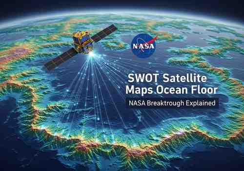
SWOT Mission Enhances Ocean Floor Mapping
NASA has generated a high-resolution map of the ocean floor using data from the Surface Water and Ocean Topography satellite. This development significantly improves understanding of underwater terrain and global water dynamics, supporting advanced research in oceanography and climate science.
Overview of the SWOT Satellite Mission
Launched in 2022, SWOT is a collaborative effort between NASA and the French space agency CNES. The mission is designed to monitor Earth’s water systems, including oceans, rivers, lakes, and reservoirs. It provides precise, large-scale data on water distribution and movement, enabling better assessment of hydrological and environmental changes.
Advanced Technology and Working Mechanism
A key feature of SWOT is the Ka-band Radar Interferometer (KaRIn), which measures water surface elevation with high accuracy. By emitting microwave signals and analysing their return, the instrument calculates variations in height and flow. This allows scientists to detect subtle changes in water bodies and even infer seafloor structures based on ocean surface variations.
Extensive Global Coverage
SWOT surveys nearly 90% of the Earth’s surface within a 21-day cycle. It can monitor rivers wider than 330 feet and track over one million lakes and reservoirs exceeding five acres. The satellite also plays a vital role in observing large-scale floods, enabling improved forecasting and disaster preparedness.
Exam-Focused Points
-
SWOT: Surface Water and Ocean Topography satellite (2022 launch)
-
Joint mission: NASA + CNES
-
Instrument: KaRIn (radar interferometer)
-
Coverage: ~90% Earth surface in 21 days
-
Application: Ocean currents, flood monitoring, water mapping
Month: Current Affairs - March 29, 2026
Category: Space, Climate Studies