NISAR Satellite Reveals Earth Through Clouds
NISAR has released new radar images showing parts of North America like Seattle, Portland, and Mount St. Helens. These regions are often covered with clouds, but the satellite can still capture clear images, showing its advanced technology.
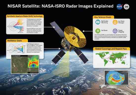
About the NISAR Mission
NISAR is a joint mission between NASA and ISRO. It is the first satellite to use dual-frequency radar, combining L-band and S-band signals. This allows it to observe Earth’s surface in all weather conditions, day or night.
Powerful Radar Technology
Unlike normal satellites that depend on sunlight, NISAR uses radar signals. These signals can pass through clouds, smoke, and even dense vegetation. The satellite has a large 12-metre antenna, which helps it capture detailed images of land, forests, and coastal areas.
Key Observations from the Images
The latest images show rivers and landscapes around Seattle and Portland, including the Columbia River. It also clearly maps the volcanic region near Mount St. Helens. These images prove how useful the satellite is for studying areas where clouds often block visibility.
Exam-Focused Points
-
NISAR: Joint mission of NASA and ISRO
-
Technology: Dual-frequency SAR (L-band + S-band)
-
Advantage: Works in all weather and at night
-
Uses: Monitoring earthquakes, volcanoes, landslides
-
Feature: Can penetrate clouds and vegetation
Importance for Earth Observation
NISAR will help scientists track climate change, natural disasters, and environmental changes more accurately. It will support disaster management, farming, and conservation efforts. The mission also shows strong cooperation between India and the United States in space research.
Month: Current Affairs - March 31, 2026
Category: Space Technology, Environment