Weather analytics: The platform supports district-level early warning systems for:
-
Rainfall variation
-
Dry spells
-
Temperature fluctuations
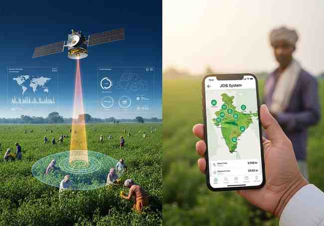
WHY THIS SYSTEM MATTERS
Before JCIS, jute monitoring was slower and less accurate. Now, officials can see crop health from space. Farmers can get alerts about bad weather. The government can estimate production more reliably. This helps in planning, pricing, and supporting jute growers.
FAQ (FREQUENTLY ASKED QUESTIONS)
Q1: What is the full name of the jute monitoring system?
A: Jute Crop Information System (JCIS).
Q2: Which two digital tools are part of the Jute Crop Information System?
A: BHUVAN JUMP (mobile app) and PATSAN (web platform).
Q3: When was JCIS launched?
A: In 2023.
Q4: Which organisations developed JCIS?
A: ISRO (Indian Space Research Organisation) and the Jute Corporation of India (JCI).
Q5: What kind of early warnings does JCIS provide?
A: Warnings about floods, dry spells, rainfall variation, temperature fluctuations, and crop stress.
EXAM-FOCUSED POINTS
-
System name: Jute Crop Information System (JCIS)
-
Launched in: 2023
-
Developed by: ISRO + Jute Corporation of India (JCI)
-
Implementing body: National Jute Board
-
Two digital tools: BHUVAN JUMP (mobile app for field monitoring) + PATSAN (web analytics platform)
-
Technologies used: Satellite imagery, weather analytics, vegetation indices, field inputs
-
Key features: Near real-time monitoring, automated reporting, early warnings
-
I-CARE network: Collects geo-tagged field data via BHUVAN JUMP
-
Crop Cutting Experiments: Use geospatial smart-sampling for better yield estimates
-
Flood impact models: Satellite-based to estimate crop and quality losses
-
Weather alerts: District-level for rainfall, dry spells, temperature changes
Month: Current Affairs - May 13, 2026
Category: JuteCropInformationSystem