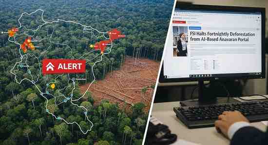
India’s Anavaran Forest Monitoring System Stops Real-Time Deforestation Updates
The Forest Survey of India (FSI) has discontinued the issuance of fortnightly deforestation alerts through its AI-driven Anavaran portal , which was designed to track forest cover loss across India. The platform, which generated near-real-time alerts using satellite imagery and machine learning, has not been updated since November 2025 . According to reports, active monitoring stopped in January 2026 , ending the regular alerts that were previously shared with state forest departments every 15 days for field verification.
Purpose of the Anavaran Monitoring System
The Anavaran–Deforestation Alert System was introduced in January 2024 to enhance the country’s forest monitoring capabilities. The portal analysed satellite imagery to identify new deforestation patches by comparing sequential images over time. Once potential forest loss was detected, location-specific alerts were sent to state forest departments to enable targeted inspections and corrective action.
The system used advanced processing tools such as Google Earth Engine to analyse satellite data and detect vegetation changes. Although it functioned operationally for nearly two years, officials have indicated that the platform was considered a pilot initiative and its performance is currently under evaluation.
Technology Behind the Platform
The monitoring framework relied on multiple satellite data sources to ensure accuracy. Optical imagery from Sentinel-2 served as the main input for detecting vegetation changes. To overcome cloud cover during monsoon seasons, radar data from Sentinel-1 was incorporated.
The system analysed historical seasonal data to identify abnormal vegetation loss and generate alerts. Using this approach, the portal achieved high spatial resolution monitoring of about 10–20 metres , allowing more precise identification of deforestation hotspots.
Data Trends from the Portal
Between January 2024 and October 2025 , FSI issued 12,351 deforestation alerts , averaging around 561 alerts per month . The number of alerts increased during the November–March period , when deforestation activities generally intensify due to favourable weather conditions.
States such as Punjab, Andhra Pradesh and Arunachal Pradesh recorded the highest number of alerts, followed by Nagaland, Manipur, Uttarakhand, Assam and Tripura . Several state forest departments confirmed that the alert notifications stopped after December 2025 .
Global Context and Future Outlook
Experts view the Anavaran system as an important step toward technology-driven forest monitoring in India. Similar remote sensing platforms operate internationally, such as the Terra-I deforestation monitoring system used in parts of Latin America. Compared with Terra-I’s 250-metre resolution, Anavaran offered higher-resolution monitoring , enabling more detailed tracking of forest changes.
With further improvements and feedback from states, such AI-powered platforms could play a crucial role in early detection of deforestation and strengthening forest conservation strategies .
Exam-Focused Points
-
Forest Survey of India functions under the Ministry of Environment, Forest and Climate Change .
-
Anavaran was an AI-based deforestation alert system using satellite imagery and machine learning.
-
The system used
Month: Current Affairs - March 11, 2026
Category: Environment & Ecology